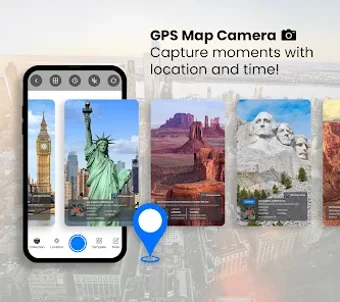
Comprehensive GPS Map Camera for Geotagging Photos
GPS Map Camera: Geotag Photo is an advanced multimedia application designed for Android users, specializing in enhancing photography through precise geotagging. The app utilizes smart GPS location technology to automatically embed timestamps and locations into photos, transforming each image into a vivid memory. Users can capture photos with detailed latitude and longitude data, ensuring that every shot tells a story about the moment and place it was taken.
Top Recommended Alternative
With features such as real-time capture, customizable photo templates, and the ability to edit geotagging information, this app provides a user-friendly experience for organizing and enhancing photographic memories. Users can easily add notes to their photos, browse images on an interactive map, and view pictures by time, making it an essential tool for anyone looking to preserve their experiences geographically.